
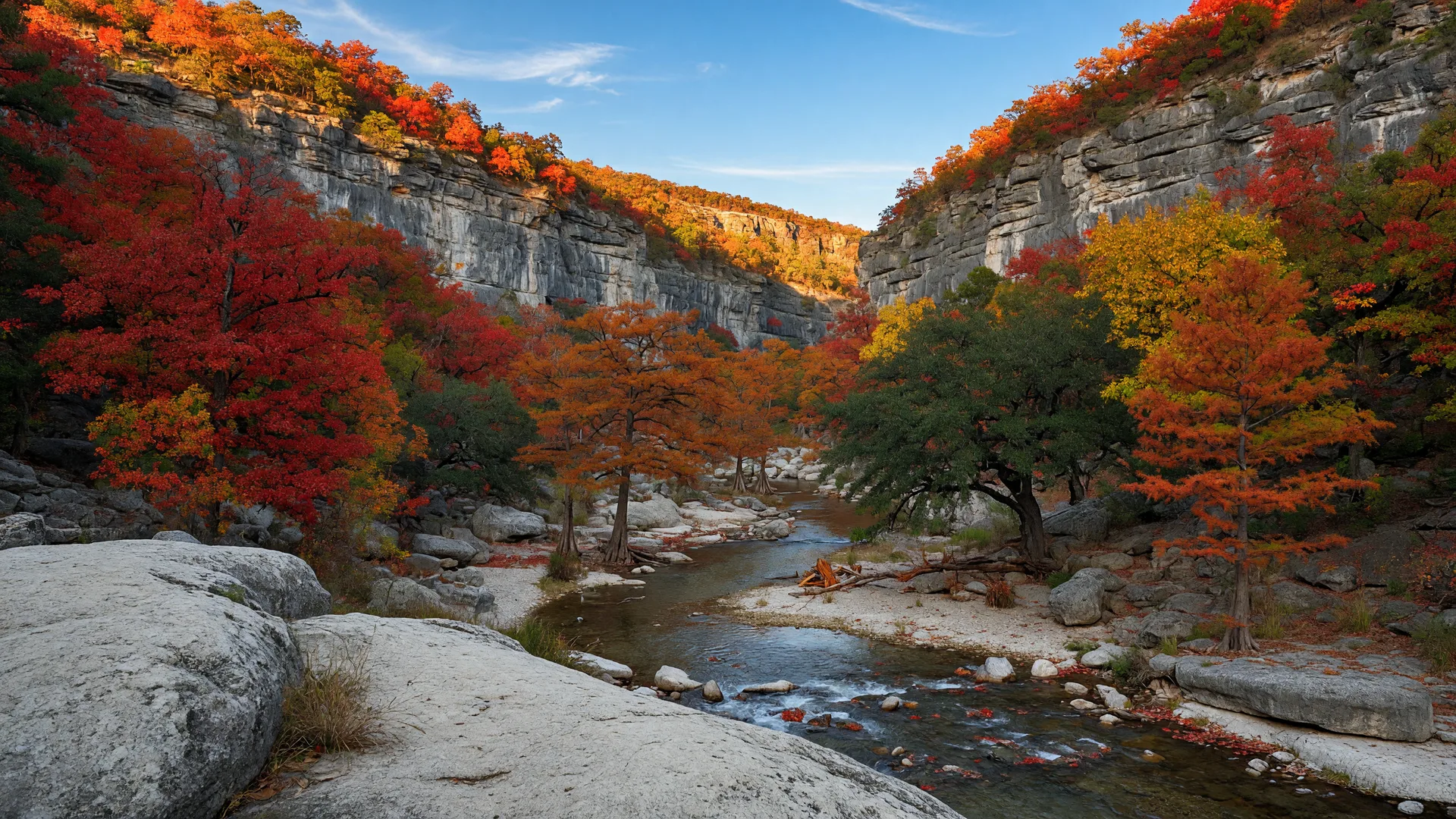
When California buyers ask what the Hill Country offers that California does not, the honest answer usually starts with space and ends with taxes. Lost Maples State Natural Area is the exception: it offers something California has only in small, scattered doses, a real autumn color display. Bigtooth maples, a tree that survives here as an Ice Age relict, turn the canyon walls crimson and gold for about three weeks each November, and the state protects the largest accessible stand of them in the country.
Lost Maples State Natural Area sits at 37221 FM 187 in Vanderpool, TX 78885, roughly 63 miles northwest of Boerne and about 91 miles from downtown San Antonio. The park covers 2,906 acres of steep limestone canyons along the Sabinal River and its tributary, Can Creek. It opened to the public in 1979 and has since become one of the most requested state parks in Texas, with day-use entry selling out on peak fall weekends.
This guide covers everything needed to plan a visit: the fall color window and how to time it, the complete trail system, camping, fees and hours, distances from Hill Country communities, the surrounding area, and how the experience compares to autumn in California.
Lost Maples at a Glance
| Detail | Value |
|---|---|
| Address | 37221 FM 187, Vanderpool, TX 78885 |
| Phone | (830) 966-3413 |
| Distance from Boerne | 63 miles, about 1 hour 15 minutes via I-10 West and FM 187 |
| Distance from Fair Oaks Ranch | 65 to 70 miles, about 1 hour 20 minutes |
| Distance from downtown San Antonio | 91 miles, about 2 hours via Hwy 16 and FM 337 |
| Total acreage | 2,906 acres |
| Day-use fee | $6 per person (ages 13 and older); 12 and under free |
| Hours | Open daily; self-pay station for after-hours day use; headquarters roughly 8:30 AM to 4:30 PM |
| Camping | 30 drive-up sites with water and electric, plus hike-in primitive sites |
| Best season | Late October through mid-November for fall color; spring for wildflowers and cooler hiking |
Why the Fall Color Exists at All
The trees that draw the crowds are bigtooth maples, Acer grandidentatum, and they are not supposed to be here. The species is a relict population left over from the last Ice Age, roughly 10,000 years ago, when a cooler, wetter climate allowed northern hardwoods to grow across the Texas Hill Country. As the climate warmed, the maples retreated to the steep, north-facing limestone canyons where cool air pools and moisture lingers. Lost Maples protects one of the largest and most isolated stands of bigtooth maple in the United States.
Bigtooth maple is essentially the only native maple in Texas. The tree is named for its leaves, which are broader and more rounded than the classic sugar maple, with shallow lobes and a coarse-toothed edge. In most years the color runs from deep red to orange to gold, and the display peaks for a short window: typically the last two weeks of October through the first two weeks of November, with the most reliable color most often falling in the first two weeks of November.
The park also holds the state champion bigtooth maple, a specimen recorded in 2006 at roughly 40 feet tall with an 85-inch trunk circumference. It is not marked on the main trails, but the tree's existence is a reminder of how old and how rare this population is.
Timing the Fall Color: Late October Through Mid-November
The color window is narrow and variable. TPWD posts weekly fall foliage reports starting in October, and the reports are the single most reliable way to time a visit. A hard freeze or a dry late summer can shorten the display; a mild, wet September tends to extend it. Plan for the first two weeks of November as the most likely peak, and check the foliage report the week before you drive.
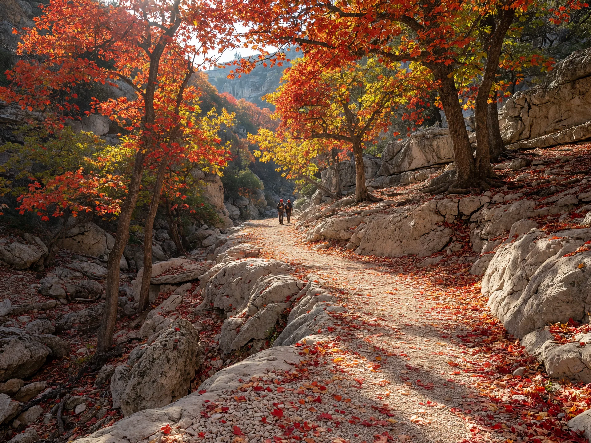
Peak weekends are the busiest days of the year for the park. Day-use entry frequently sells out, and TPWD recommends booking online before visiting. The practical advice for a California relocator who wants the experience without the crowd is to go on a weekday in the first half of November, arrive by mid-morning, and take the West Trail, which holds the color longer than the lower East Trail because the north-facing slopes stay cooler.
The 2026 Window
Based on the historical pattern, plan for the first two weeks of November, with the last week of October as a backup window. Book day-use entry and campsites online ahead of peak weekends; both sell out. TPWD's weekly foliage report, published on its Lost Maples page from October through November, tells you when the color is actually at its best in a given year.
The Trail System: 11 Miles of Canyon Hiking
The park maintains over 10 miles of trails, roughly 11 miles total, that climb from the Sabinal River floodplain to the canyon rim. The signature feature is a loop along the top of a cliff roughly 2,200 feet above the valley floor, with overlooks that include the aptly named Birds Eye View. The trails are well marked, and the elevation change is real: the East and West Trails both gain several hundred feet of elevation, which makes them feel like a genuine hike rather than a nature walk.
| Trail | Distance | Difficulty | Highlights |
|---|---|---|---|
| Maple Trail | 0.4 miles | Easy | The quickest look at a large stand of bigtooth maples; connects to the East Trail |
| East-West Trail | 1.0 mile | Easy | Connector that leads to the Birds Eye View overlook |
| East Trail | 3.1 miles | Moderate | Follows the Sabinal River with several crossings; passes Monkey Rock and The Grotto, a fern-covered drip-spring grotto in carved cliffs |
| West Trail | 3.6 miles | Moderate to strenuous | Crosses Can Creek near its confluence with the Sabinal, climbs to the caprock, and offers the best fall color and canyon overlooks |
| West Loop Trail | 2.4 miles | Moderate | Western canyon and woodland loop with additional maple stands and views |
Which Trail Should You Take?
For a first visit with limited time, the Maple Trail plus the East-West Trail to the Birds Eye View overlook delivers the color and the canyon view in under two hours. For the full experience, hike the West Trail, which holds the color longer and ends at the caprock overlooks. The East Trail is the better choice in summer, when the river crossings and the shaded grotto make the heat tolerable. All trails allow hiking and biking for the first mile from the trailhead; beyond that they are hiking only.
Camping at Lost Maples
The park offers 30 drive-up campsites with water and electric hookups (30-amp) at $20 per night, plus hike-in primitive and backpack campsites at $10 per night. The camping fee is in addition to the day-use entrance fee, and each extra vehicle in a campsite costs $5. Quiet hours run from 10:00 PM to 6:00 AM. Camper check-in windows are 8:00 to 10:00 AM and 1:00 to 4:30 PM.
Reservations are made through the Texas State Parks reservation system at texasstateparks.reserveamerica.com. Peak fall weekends book out weeks ahead, and the same is true of spring break. Weekday sites in November are easier to secure, and cancellations do open up within 48 hours of a reservation date, so checking the portal the day before a planned trip can yield a site.
For visitors who do not want to camp, the surrounding area has cabin options: the Lodges at Lost Maples offers five private cabins along Ranch Road 337, Lost Maples Lodging and RV Park rents seven one-bedroom cabins from about $125 per night, and Lost Maples River Lodge is a vacation rental on the Sabinal River. None of these are in the park, so book directly with the operators.
Fees, Hours, and Practical Details
Entry and Hours
Day-use entry is $6 per person for ages 13 and older; children 12 and under enter free. The Texas State Parks Pass ($70 for adults) covers entry for the pass holder and accompanying guests in one vehicle, and it pays for itself quickly for anyone planning multiple park visits. The park has no entry gate; a self-pay station outside park headquarters handles after-hours day use, and headquarters is open roughly 8:30 AM to 4:30 PM daily.
What to Bring
- Water. There is no water along the trails. Carry at least a liter per person per hour of hiking, more in summer.
- Sturdy shoes. The trails are rocky limestone with real elevation change. Trail runners or hiking boots matter more here than at Guadalupe River State Park.
- Layers. November mornings in the canyon can start in the 40s and end in the 70s. The temperature swing is larger than anything on the coast.
- Cash or card for the self-pay station. The station accepts both, but plan to pay before or after headquarters hours.
Nearby Services
Vanderpool is a very small community. The closest full-service town is Medina, roughly 15 minutes east on FM 337, with a general store, gas, and a few dining options. Bandera, about 40 minutes southeast, is the closest town with a full range of services and is worth knowing as the Cowboy Capital of the World. For a meal on the way, Mac & Ernie's Roadside Eatery in Tarpley is a well-known stop on the route from Boerne.
The Drive and What Is Around the Park
The drive from Boerne is part of the experience. The most direct route runs I-10 West to Comfort, then FM 473 and FM 187 southwest through the hills to Vanderpool, about 63 miles and 1 hour 15 minutes. From San Antonio, the classic route is Hwy 16 North to Medina, left on FM 337 to Vanderpool, and 5 miles north on FM 187: about 91 miles and 2 hours. Fair Oaks Ranch, just off the same I-10 corridor as Boerne, lands at roughly 65 to 70 miles and 1 hour 20 minutes.
The roads around the park are the attraction for many visitors. The Twisted Sisters, a roughly 100-mile loop of FM 335, FM 336, and FM 337, is one of the most celebrated driving and motorcycling routes in Texas, and FM 337 passes directly through Vanderpool. The Devil's Sinkhole State Natural Area near Rocksprings, about 30 miles west, is a National Natural Landmark cave with millions of bats; access is by guided tour only, arranged through the Devil's Sinkhole Society at (830) 683-2287, with tours meeting at the visitor center at 101 N. Sweeten St. in Rocksprings.
For a post-hike stop, 187 North Winery and Brewery in Vanderpool sits steps from the park and serves handcrafted wines and small-batch brews. The broader Hill Country wine scene, including the corridor closer to Boerne, is covered in the Comfort and Sisterdale wine corridor guide.
How It Compares to Autumn in California
California has fall color, but it is a different palette. The Eastern Sierra and the High Sierra are dominated by golden-yellow aspens and cottonwoods, with red maples and orange oaks playing a supporting role. A California transplant who grew up with the aspens of Hope Valley or the cottonwoods of the Central Valley will recognize the gold at Lost Maples immediately; the crimson is the part that is genuinely new.
The scale is different too. California's color is spread across mountain ranges and requires a road trip measured in hours. Lost Maples concentrates its display in a single canyon system, and the entire park is 2,906 acres. The practical difference for a Hill Country resident is that the peak display is a 1 hour 15 minute drive from Boerne, not a weekend trip to another region of the state. You can go for the afternoon.
How Lost Maples Fits the Hill Country Park System
For California relocators building a mental map of the region's outdoor options, here is how Lost Maples sits alongside the other major parks within reach of Boerne.
| Park | Drive from Boerne | Best For | Key Feature |
|---|---|---|---|
| Lost Maples SNA | 1 hr 15 min | Fall color, canyon hiking, camping | Bigtooth maple display; 2,906 acres; no swimming |
| Guadalupe River SP | 30 min | Swimming, tubing, camping, hiking | River access for families; 85 developed campsites |
| Government Canyon SNA | 40 min | Hiking, mountain biking, dinosaur tracks | 40+ miles of trails; no swimming or camping |
| Enchanted Rock SNA | 1 hr 10 min | Summit hiking, rock climbing, stargazing | Massive granite dome; dark sky designation |
"Lost Maples is the one Hill Country park with a season. For three weeks each November the canyon turns crimson and gold, and for a California transplant who assumed Texas was all cedar and oak, it is the fastest way to understand what the Hill Country actually is: a landscape with real seasons, real elevation, and real surprises."
Why This Park Matters for California Relocators
Lost Maples matters for two reasons. The first is practical: it is the closest genuine fall color display to Boerne and San Antonio, and it is a 1 hour 15 minute drive rather than a flight. The second is perceptual. Many California buyers picture Texas as flat, brown, and treeless. A November afternoon on the West Trail, with bigtooth maples on limestone cliffs above a spring-fed creek, corrects that picture faster than any market statistic.
The park is also a reminder that the Hill Country's outdoor recreation is not all river-based. Guadalupe River State Park covers the water, Government Canyon covers the mountain biking and the dinosaur tracks, Enchanted Rock covers the summit and the dark sky, and Lost Maples covers the season. Together they give a relocating family a full year of weekend options within a short drive of home.
For a broader overview of parks across the region, see our state and local parks guide. For the fall season as a whole, including events and the best months for the move itself, see the fall in the Hill Country guide. And for the dark sky side of the western Hill Country, including the stargazing that pairs well with a Lost Maples trip, see the dark skies and stargazing guide.

Written by
Bill Ross
Hill Country Homesteads Group, brokered by KW Boerne
Bill Ross is a Texas real estate agent with nearly four decades in high-tech sales and a network of 1,100+ California real estate agents for coordinated cross-state transactions. Featured in national coverage discussing his family's relocation from Silicon Valley to the Texas Hill Country. He covers the Texas Hill Country including Boerne, Fair Oaks Ranch, San Antonio, and surrounding communities.
Related Guides
State and Local Parks Near Boerne
Complete overview of parks across the Hill Country with distances, fees, and trail details for each location.
Enchanted Rock State Natural Area Guide
Summit hiking, rock climbing, camping, and dark sky stargazing on the Hill Country's granite dome.
Fall in the Hill Country
What autumn weather, parks, and events are actually like, and why fall is a practical window for the move.
Choosing Your Hill Country Park
A decision framework for matching the region's parks to your family's recreation style.
Sources
- Lost Maples State Natural Area -- fees, hours, camping, and overview -- Texas Parks and Wildlife Department (TPWD). tpwd.texas.gov
- Lost Maples entrance fees -- TPWD, Fees & Facilities. tpwd.texas.gov
- Lost Maples campsites and rates -- TPWD, Fees & Facilities. tpwd.texas.gov
- Lost Maples trails information -- TPWD, Trails Info. tpwd.texas.gov
- Lost Maples fall foliage color reports -- TPWD. tpwd.texas.gov
- Lost Maples nature and the bigtooth maple relict population -- TPWD and Texas Parks & Wildlife Magazine.
- Devil's Sinkhole State Natural Area guided tour information -- TPWD and the Devil's Sinkhole Society.
- Twisted Sisters scenic loop (FM 335, 336, 337) -- regional driving guides.
Last reviewed: October 2026. Sources verified for accuracy.