
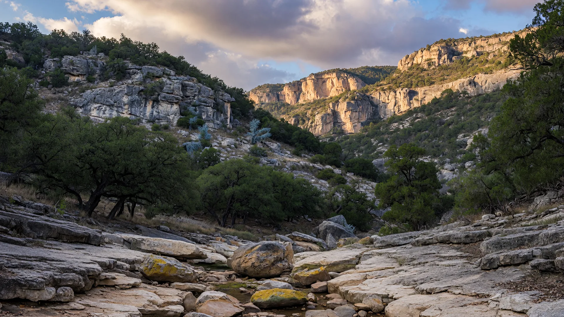
When California buyers evaluating the Texas Hill Country ask where they can hike on a Saturday morning without driving an hour and a half, Government Canyon State Natural Area is the answer they need. It sits 12,064 acres on the northwest edge of San Antonio, less than 40 minutes from Boerne and Fair Oaks Ranch, with more than 40 miles of trails across limestone canyons, live oak woodlands, and the recharge zone of the Edwards Aquifer.
Government Canyon is not a traditional state park with swimming beaches, fishing piers, or a visitors center with interactive exhibits. It is a state natural area, and its primary mission is watershed protection. That distinction matters: the facilities are simpler, the rules reflect conservation priorities, and the visitor experience is built around hiking, mountain biking, and wildlife observation rather than recreation amenities. For California relocators who value undeveloped natural spaces, that is an advantage, not a limitation.
This guide covers everything needed to plan a visit: the trail system, the dinosaur trackway, mountain biking routes, geology and the Edwards Aquifer, entrance fees and hours, distances from Hill Country communities, and practical tips for first-time visitors.
Government Canyon at a Glance
| Detail | Value |
|---|---|
| Total acreage | 12,064 acres (largest state natural area near San Antonio) |
| Trail mileage | 40+ miles of designated trails |
| Distance from Boerne | 35 to 45 minutes via I-10 East and Loop 1604 |
| Distance from Fair Oaks Ranch | 30 to 40 minutes via I-10 East |
| Distance from downtown San Antonio | ~25 minutes (18 miles via Loop 1604) |
| Day-use entrance fee | $6 per person (ages 13 and older); 12 and under free |
| Gate hours | 7:00 AM to sunset (office opens at 8:30 AM) |
| Days open | Friday through Monday; closed Tuesday and Wednesday |
| Primary use | Hiking, mountain biking, trail running, wildlife observation |
| Key restriction | No swimming, fishing, camping, or dogs on most trails |
Hiking Trails: Over 40 Miles of Canyon and Ridge Routes
Government Canyon's trail system is the primary reason to visit. With more than 40 miles of maintained trails spread across varied terrain — from flat canyon floor paths to steep limestone ridge climbs — the park offers enough distance and variety that regular visitors can spend months exploring without repeating routes.
Trails are divided into front country (closer to the parking area, generally easier) and back country (deeper into the natural area, more demanding). Mountain bikes are permitted on designated front country and back country trails. Hiking is permitted on all trails.
| Trail | Distance | Difficulty | Bikes | Highlights |
|---|---|---|---|---|
| Recharge Trail | 1.0 mile | Easy | Hike only | Interpretive trail with signs about the Edwards Aquifer |
| Blanco Sink Trail | 1.5 miles | Moderate | Hike only | Leads to a large sinkhole on the Edwards Aquifer recharge zone |
| Joe Johnston Route | 5.7 miles | Moderate | Hike only | Primary route to the dinosaur trackway |
| Overlook Trail | 2.5 miles | Moderate | Hike only | Panoramic views over the canyon and Hill Country terrain |
| Government Canyon Outer Loop | 14.9 miles | Moderate to strenuous | Bikes allowed | Full perimeter loop; best done as a half-day or full-day trek |
| Sendero Balcones | 6.0 miles | Moderate | Bikes allowed | Runs along the Balcones Escarpment with limestone outcroppings |
| Creekside Trail | 1.4 miles | Easy | Hike only | Flat path along Government Canyon Creek; good for families |
| Wildcat Canyon Trail | 3.6 miles | Strenuous | Hike only | Steep climb through a side canyon with significant elevation gain |
The Dinosaur Trackway: 110 Million Years in Limestone
Government Canyon contains one of the most accessible dinosaur trackway sites in Texas. Three distinct track sites are exposed in the limestone bed of Government Canyon Creek, visible during dry conditions. The tracks were made during the Early Cretaceous Period, approximately 110 million years ago, when the area was a muddy shoreline of the ancient Gulf of Mexico.
The three sites are:
- Lower Theropod Track Site — 27 individual tracks from a large theropod (a bipedal carnivorous dinosaur). The tracks measure roughly 18 inches long, suggesting an animal roughly the size of an Acrocanthosaurus, a predator that stood 15 to 17 feet tall at the hip and reached lengths of 38 feet.
- Sauropod Track Site — Large, rounded tracks from a sauropod (a long-necked herbivore). These tracks are less distinct than the theropod prints but cover a wider area of the creek bed.
- Upper Theropod Track Site — A second set of theropod tracks, slightly smaller and less well preserved than the lower site, located further upstream.
Access to the trackway requires hiking the Joe Johnston Route (5.7 miles round trip) or shorter route combinations. The tracks are visible only when the creek is dry. After rain, the sites flood and become inaccessible. Visiting during a dry stretch is essential. The park provides condition updates at the visitor center, and trackway status can also be checked by calling the park office.
For California relocators accustomed to the fossil sites of the West Coast, Government Canyon's dinosaur tracks compare favorably with sites like the Painted Desert in Petrified Forest National Park or the dinosaur footprints at Picketwire Canyon in Colorado. The scale and accessibility are different, but the experience of standing where a dinosaur walked 110 million years ago, in a dry limestone creek bed in the middle of a Hill Country canyon, is genuinely remarkable.
Mountain Biking at Government Canyon
Government Canyon is one of the premier mountain biking destinations in the San Antonio area. The park maintains designated multi-use trails that welcome mountain bikers, and the terrain — limestone ridges, rolling hills, and canyon descents — provides a technical and varied riding experience.
The primary biking route is the Government Canyon Outer Loop, a 14.9-mile circuit that circles the western edge of the natural area. The trail surface is a mix of hard-pack limestone, loose gravel, and exposed bedrock sections. Climbs are sustained but not punishing, and the descents offer fast, flowing sections with enough technical features to keep experienced riders engaged. Intermediate to advanced riders will find the Outer Loop rewarding. Beginners may prefer the Sendero Balcones Trail (6 miles), which has gentler gradients and fewer rock gardens.
Bikes are not permitted on the hike-only trails, including the Joe Johnston Route to the dinosaur trackway and the Overlook Trail. Mountain bikers should check at the visitor center for current trail conditions and any seasonal closures. The park's mountain bike community is active, with regular group rides organized through local shops and the San Antonio Mountain Bike Association.
For California mountain bikers moving from areas with extensive trail systems (Santa Cruz, Marin, the South Bay), Government Canyon is a solid local option — less technical than the California gold standard, but with enough mileage and variety to justify the drive from any Hill Country community.
Geology and the Edwards Aquifer: Why This Land Is Protected
Government Canyon's name comes from a brief period in the 1870s when the canyon was used as a camp by the U.S. Army's "Buffalo Soldiers" of the 10th Cavalry. But the land's significance goes far deeper than that history. The natural area sits directly on the recharge zone of the Edwards Aquifer — the primary water source for over 2 million people in the San Antonio region.
The Edwards Aquifer is a karst limestone aquifer formed over millions of years as mildly acidic groundwater dissolved fractures and cavities in the Cretaceous limestone. The recharge zone consists of porous limestone layers that allow rainwater and creek water to percolate directly into the aquifer below. Government Canyon's 12,000-plus acres act as a natural filtration and recharge system for this critical water supply.
This geological context explains almost everything about the park's rules. No camping, no dogs on most trails, no swimming, no fishing — every restriction exists to protect water quality. The karst landscape is fragile. Sinkholes, caves, and solution channels can carry surface contaminants directly into the aquifer with minimal natural filtration. Visitors who understand this context generally appreciate the rules rather than resenting them.
The canyon itself is cut into the Balcones Escarpment, the geological fault line that defines the eastern edge of the Texas Hill Country. The escarpment runs from the Rio Grande near Del Rio northeastward to the Dallas area, marking the boundary between the Edwards Plateau (the Hill Country) and the Gulf Coastal Plains. Government Canyon sits at this geological transition, which is part of what makes its landscape so varied — steep limestone cliffs and canyons dropping into the flat coastal plain below.
For California relocators, the connection between the landscape and the water supply is one of the most important practical differences between living in the Hill Country and living in California. The Edwards Aquifer is not the Sierra snowpack. It is a finite underground reservoir recharged by local rainfall, and the rules that protect it affect daily life for anyone who owns property in the region. Understanding the recharge zone is part of understanding the land. See our well water guide and water infrastructure page for more on how this affects homeowners.
Practical Tips for First-Time Visitors
Government Canyon operates differently from a typical state park. The rules and logistics reflect its dual mission of recreation and watershed protection. Here is what first-time visitors need to know.
When to Visit
The park is open Friday through Monday only. It is closed Tuesday and Wednesday. Gates open at 7:00 AM and close at sunset. The office and visitor center open at 8:30 AM. On weekends the parking lot often fills by mid-morning, especially during spring wildflower season (March through May) and fall (October through November). Arriving by 8:00 AM is the most reliable strategy for guaranteed entry.
The best hiking season is October through May. Summer daytime temperatures above 95 degrees, combined with the exposed limestone terrain that reflects and radiates heat, make midday hiking uncomfortable and potentially dangerous. Early morning summer hikes are possible but require an earlier start and more water.
What to Bring
- Water. At least one liter per person per hour of hiking. There is no potable water on the trails. The visitor center has water for filling bottles, but once you leave the front country, you are on your own.
- Sun protection. Hat, sunscreen, and sunglasses. The limestone terrain and open canyon sections provide limited shade.
- Sturdy footwear. The trails are rocky and uneven. Hiking boots are recommended. Trail running shoes work for experienced hikers on the front country trails.
- Map. Cell service is unreliable in the back country. Download the park map before arriving or pick up a paper copy at the visitor center.
Rules to Know
- No dogs on most trails. Dogs are only permitted on the Recharge Trail (the short interpretive loop near the visitor center) and must be leashed at all times. Service animals are exempt but must be registered at the office.
- No camping. Government Canyon does not have camping facilities. This is a day-use only natural area.
- No swimming or fishing. The creek is part of the aquifer recharge system and not open for recreation.
- No glass containers or alcohol. Standard Texas State Natural Area rule.
- No firearms. Prohibited in all Texas State Parks and Natural Areas.
Nearby Amenities
The closest town with full services is San Antonio, approximately 18 miles east on Loop 1604. The intersection of Loop 1604 and Bandera Road (Texas Highway 16), about 15 minutes from the park entrance, has grocery stores, gas stations, fast food, and several sit-down restaurants. The park has picnic tables near the parking area but no food service. Pack a lunch or plan to eat before or after your visit.
How to Get In: Fees and Entry
Government Canyon charges a day-use fee of $6 per person for ages 13 and older. Children 12 and under enter free. The Texas State Parks Pass ($70 for adults) covers entry for the pass holder and accompanying guests (up to one vehicle). Group rates are available for organized groups of 10 or more at $1 per person.
Reservations are recommended on weekends and during peak seasons. Day passes can be purchased online through the Texas State Parks reservation system up to 30 days in advance. Weekday visits without a reservation are accepted on a first-come, first-served basis until capacity is reached. The park has a capacity limit on the number of visitors allowed at one time, primarily to protect the recharge zone.
The park entrance is located at 12861 Galm Road, San Antonio, TX 78254. From Boerne, take I-10 East to the Loop 1604 exit, head south on 1604 for approximately 8 miles, then turn right onto Galm Road. The entrance is 1.5 miles down Galm Road on the left. From Fair Oaks Ranch, the drive is slightly shorter — take I-10 East to the Ralph Fair Road exit, head south to Loop 1604, and follow the same route.
Address
12861 Galm Road, San Antonio, TX 78254
Approximately 35 to 45 minutes from Boerne, 30 to 40 minutes from Fair Oaks Ranch, 25 minutes from downtown San Antonio.
Why Government Canyon Matters for California Relocators
For California buyers evaluating a move to the Texas Hill Country, Government Canyon answers a practical question: what is the closest place I can go for a real hike without spending half the day driving? The answer is a 12,064-acre natural area with 40 miles of trails, 110-million-year-old dinosaur tracks, and a trail system that supports mountain biking, trail running, and serious hiking — all within 40 minutes of Boerne, Fair Oaks Ranch, and the Hill Country corridor.
The Hill Country's outdoor recreation scene is not the Sierra Nevada. It is not the Pacific Coast trail system. But it is real, it is accessible, and for people who make the move, it becomes part of the weekly routine. Government Canyon is one of the places that makes that routine work.
For a broader overview of state and local parks in the region, see our complete parks guide. For mountain biking, rock climbing, and active recreation specifically, see the active outdoor recreation guide. And for the Guadalupe River recreation scene, see the Guadalupe River guide.

Written by
Bill Ross
Hill Country Homesteads Group, brokered by KW Boerne
Bill Ross is a Texas real estate agent with nearly four decades in high-tech sales and a network of 1,100+ California real estate agents for coordinated cross-state transactions. Featured in national coverage discussing his family's relocation from Silicon Valley to the Texas Hill Country. He covers the Texas Hill Country including Boerne, Fair Oaks Ranch, San Antonio, and surrounding communities.
Related Guides
State and Local Parks Near Boerne
Complete overview of parks across the Hill Country with distances, fees, and trail details for each location.
Active Outdoor Recreation in the Hill Country
Mountain biking, rock climbing, road cycling, trail running, and disc golf — trail data, distances, and costs.
Guadalupe River Recreation Guide
Tubing, fishing, kayaking, and swimming access on the Hill Country's defining waterway.
Enchanted Rock State Natural Area Guide
The Hill Country's defining granite dome with summit hiking, rock climbing, camping, and dark sky stargazing.
Sources
- Government Canyon State Natural Area — fees, trails, and regulations — Texas Parks and Wildlife Department (TPWD). tpwd.texas.gov
- Government Canyon entrance fees and operating hours — TPWD, Fees & Reservations page. tpwd.texas.gov
- Government Canyon dinosaur trackway information — Texas Parks and Wildlife Magazine, "Walk With the Dinosaurs." tpwmagazine.com
- Government Canyon trail system and mileage — AllTrails, Government Canyon State Natural Area page. alltrails.com
- Government Canyon acreage and geological overview — Wikipedia. wikipedia.org
- Edwards Aquifer recharge zone and Government Canyon — Edwards Aquifer Authority. edwardsaquifer.org
- Mountain biking at Government Canyon — San Antonio Mountain Bike Association. samountainbike.com
- Government Canyon visitor guide — Texas State Parks, Government Canyon page. tpwd.texas.gov
Last reviewed: July 2026. Sources verified for accuracy.