
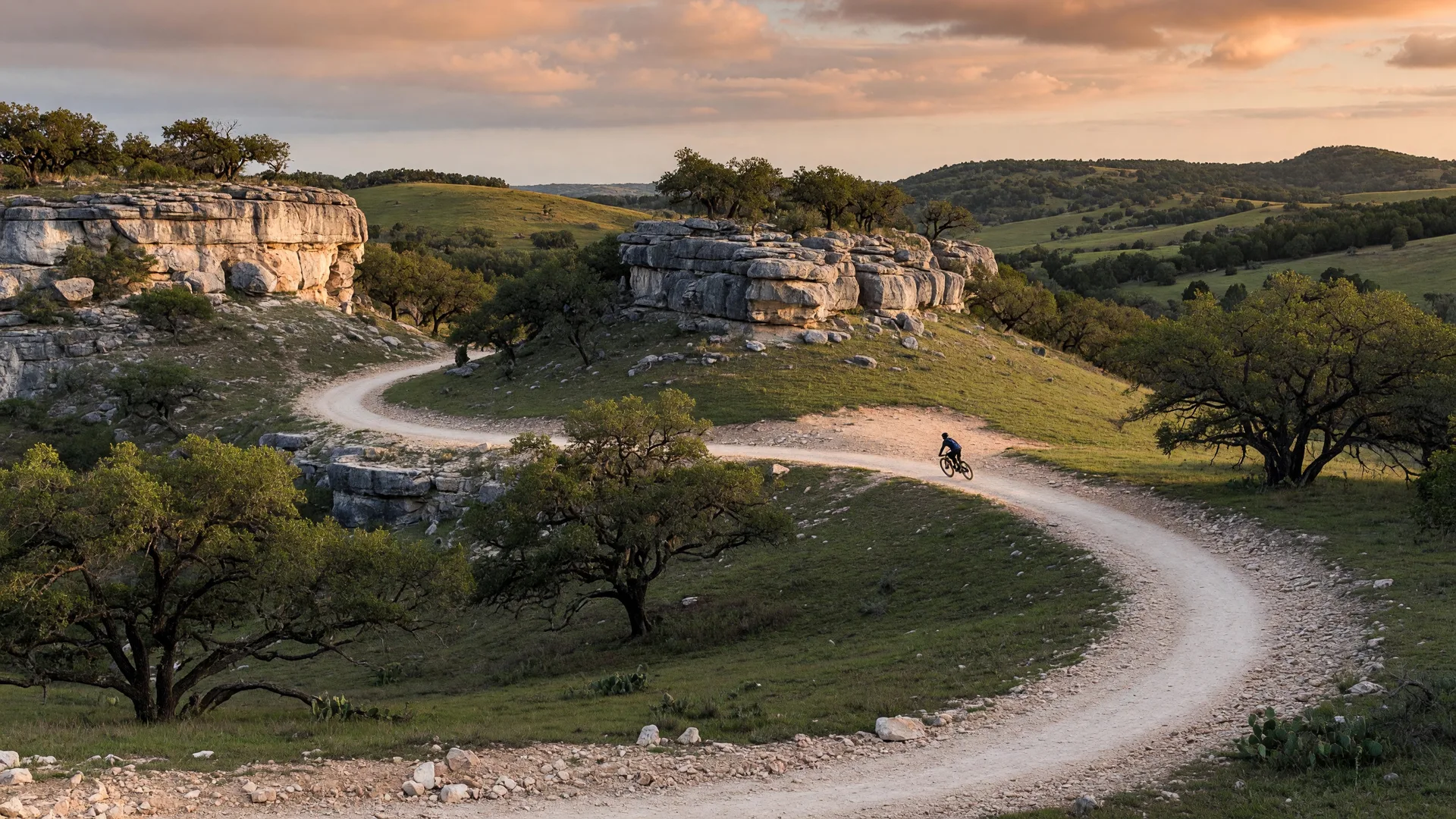
California relocators who spend weekends on singletrack, in climbing gyms, or on group rides tend to ask the same question early in the process: will I still have an active outdoor life after the move? The Hill Country has its own version of that life, and for many people it turns out to be more accessible — not more dramatic — than what they left behind.
This guide covers the specific outdoor activities that active California buyers ask about most: mountain biking trail systems, rock climbing at Enchanted Rock and beyond, road cycling routes and community rides, trail running clubs and races, and disc golf courses. Each section includes real trail names, distances, difficulty ratings, and practical details for getting started.
For state park destinations, swimming, fishing, and tubing, see our guides to state and local parks and the Guadalupe River. This article focuses on the activities that land-based athletes care about.
Activities at a Glance: Distances and Costs from Boerne
| Activity | Primary Locations | Drive from Boerne | Cost |
|---|---|---|---|
| Mountain Biking | Flat Rock Ranch, Government Canyon, McAllister Park | 15–45 min | Free–$8 |
| Rock Climbing | Enchanted Rock State Natural Area | 55–65 min | $8 per person |
| Road Cycling | Country roads around Boerne, Comfort, Sisterdale | 0–15 min (from Boerne) | Free |
| Trail Running | Cibolo Trail, Government Canyon, Friedrich Wilderness | 10–45 min | Free–$6 |
| Disc Golf | Boerne City Lake, Nani Falcone, McClain Park | 5–40 min | Free |
Costs reflect day-use or entry fees. An annual Texas State Parks pass ($70 per adult) covers entry at all state parks including Enchanted Rock and Government Canyon, and pays for itself in about nine visits.
Mountain Biking: The Trail Systems Near Boerne
Mountain biking in the Hill Country has a devoted local following and several well-built trail systems. The terrain — limestone ridges, cedar breaks, creek crossings, and rolling hills — produces trails that are technical and tight rather than fast and flowy. If you are accustomed to the smooth, machine-built flow trails of California's purpose-built parks like Santa Cruz or Trestle, expect a different riding style here. The Hill Country rewards precise bike handling and rewards riders who are comfortable on rocky, uneven surfaces.
Flat Rock Ranch (Comfort, TX)
Flat Rock Ranch is the premier mountain bike trail system in the immediate Hill Country, located about 15 minutes west of Boerne near Comfort. The ranch is privately owned and operates as a fee-based trail system open to riders. It offers approximately 18 miles of singletrack across multiple loops of varying distance and difficulty.
The Upper Loop — the signature ride — covers approximately 11 miles with 1,263 feet of elevation gain. Rated as a blue-difficulty trail, it features rocky technical sections, punchy climbs, and descents through limestone terrain. The physical rating is moderate, but the technical features demand attention. This is not a beginner trail, but riders with solid skills will find it genuinely rewarding.
Shorter loops are available for less experienced riders or for days when you want a quicker session. The trail system is well-maintained and clearly marked. Flat Rock Ranch charges a day-use fee for trail access, and annual memberships are available for regular riders.
Location
1045 PR 2182, Comfort, TX 78013
Distance from Boerne
Approximately 15 minutes via TX-46 West and PR 2182
Trail Details
18 miles of singletrack. Upper Loop: 11 miles, blue difficulty, 1,263 ft elevation gain. Multiple shorter loops available.
Government Canyon State Natural Area
Government Canyon offers over 40 miles of designated trails for hiking, mountain biking, and trail running on 12,064 acres of Edwards Aquifer recharge zone. The mountain biking trails range from easy canyon-floor paths to steep limestone ridge climbs. The back country trails are more demanding and provide a genuine Hill Country riding experience.
The park is open Thursday through Monday (closed Tuesday and Wednesday) with a $6 per person day-use fee. Government Canyon sits on San Antonio's northwest side, about 35 to 45 minutes from Boerne. It is a natural area rather than a purpose-built bike park — the trails follow the terrain rather than being shaped for speed — but the scale of the trail network makes it one of the best options for regular riding in the region.
Address
12861 Galm Road, San Antonio, TX 78254
Distance from Boerne
Approximately 35 to 45 minutes via I-10 East and Loop 1604
Hours
Thursday–Monday, 8 a.m. to 5 p.m. (last entry 4 p.m.). Closed Tuesday and Wednesday.
Other Mountain Biking Options
McAllister Park on San Antonio's north side offers a 6.2-mile Blue Loop Trail rated as moderately challenging, suitable for intermediate riders. It is about 35 minutes from Boerne and is free to enter. The trail is more accessible than Flat Rock Ranch and works well for a quick after-work ride.
O.P. Schnabel Park, also on San Antonio's northwest side, offers over 8 miles of mixed-surface trails including mountain biking. The terrain is less technical than Flat Rock or Government Canyon but still provides a solid Hill Country riding experience.
The Cibolo Trail in Boerne offers a 1.7-mile paved path suitable for casual cycling and family rides, though it is not mountain biking terrain. It is useful for riders who want a quick, easy spin close to home.
"Hill Country mountain biking is technical and rocky. The limestone terrain produces trails that demand precision over speed. If you are coming from California's flow trails, give yourself a few weeks to adjust to the riding style — and then you will start to appreciate what the limestone provides."
Rock Climbing at Enchanted Rock and Beyond
Enchanted Rock State Natural Area is the primary rock climbing destination in the Texas Hill Country, and it is one of the most significant climbing areas in the state. The park sits on a massive pink granite dome — an exposed batholith formed roughly 1.1 billion years ago — that rises approximately 425 feet above the surrounding terrain. The climbing here is real, varied, and well-established.
Route Inventory and Difficulty
According to Mountain Project, Enchanted Rock has approximately 231 recorded rope routes and 135 bouldering routes. The rope routes range from 5.5 to 5.13 in difficulty, with 183 trad routes, 79 top-rope routes, and 52 sport routes. The bouldering ranges from V0 to V8, with the majority of problems at the easier end (V0 to V1), making it accessible for beginners.
The climbing is primarily traditional (trad) in style, meaning climbers place their own protection in cracks and features rather than relying on pre-placed bolts. Run-outs — the distance between protection points — are common and longer than what California sport climbers are accustomed to. If you are coming from California's well-bolted sport crags at Joshua Tree, Mission Gorge, or the granite domes near Tahoe, this is a meaningful adjustment. The climbing culture at Enchanted Rock values self-sufficiency and conservative judgment.
Climbing Areas Within the Park
Echo Canyon is the highest-density climbing area, with routes concentrated on the canyon walls. Notable routes include Middle Crack (5.7+), which is a good introduction to the style. Buzzard's Roost offers more remote traditional routes, including Texas Crude (5.10b). Little Dome is the primary bouldering area with a high concentration of V0 to V3 problems. Freshman Mountain and The Kingdom provide additional bouldering and mixed climbing.
Beginners should start with bouldering on Little Dome or guided sessions. Rock-About and other local outfitters offer half-day and full-day guided climbing trips that include instruction, gear, and access to appropriate routes. Guided sessions typically cost $150 to $250 per person for a half day.
Address
16710 Ranch Road 965, Fredericksburg, TX 78624
Distance from Boerne
Approximately 55 to 65 minutes via TX-46 East and Ranch Road 965
Requirements
Day-use fee: $8 per person. Climbers must check in at headquarters and sign a waiver. Advance reservations required on weekends and holidays. Pitons are prohibited.
For California relocators who climbed regularly at Joshua Tree, Yosemite, or the Bay Area granite, Enchanted Rock is not a replacement for those venues — and it would be misleading to suggest otherwise. What it does offer is a distinctive climbing experience on ancient granite in a setting that feels remote and uncrowded. The slab and friction climbing style is well-suited to the dome's natural features, and the winter climbing season (November through March) is genuinely excellent, with dry air, moderate temperatures, and minimal crowding.
Indoor climbing gyms exist in San Antonio for training and year-round climbing access, filling the gap during the hot summer months when outdoor climbing at Enchanted Rock is uncomfortable.
Road Cycling: Routes, Rides, and the Tour de Boerne
Road cycling in the Hill Country is defined by the terrain. The rolling limestone hills, river crossings, and rural county roads between Boerne, Comfort, Sisterdale, and Fredericksburg produce routes with consistent climbing — not mountain passes, but relentless short, steep rollers that add up. A 40-mile ride in this area will typically include 2,000 to 4,000 feet of cumulative elevation gain depending on the route, which is more climbing than many California riders expect from "flat" Texas.
Popular Routes from Boerne
Boerne to Comfort — A classic local ride of approximately 22 to 42 miles depending on the loop, following FM 473 and the river road through rolling terrain. The shorter version is suitable for intermediate riders; the longer loop includes significant climbing through the hills west of Comfort.
Boerne to Fredericksburg via Luckenbach — A standard route of approximately 30 miles with roughly 1,365 feet of climbing, passing through the community of Luckenbach made famous by the Waylon Jennings song. An extended version covers 59 miles with 2,440 feet of elevation gain. This is the signature long ride of the region.
Ranger Creek Road — A shorter, punchy ride of approximately 10 miles with 747 feet of climbing, starting from I-10 near Boerne. The route includes short, steep sections that work well for interval training or a quick evening ride.
Boerne 41 — A 41-mile route with 2,271 feet of elevation gain, categorized as "somewhat hilly." This route stays close to Boerne and provides a solid training ride without committing to a full-day excursion.
Tour de Boerne
The Tour de Boerne is the area's premier annual charity cycling event, held each June from the Don Strange Ranch in the Boerne–Comfort area. The event offers three courses:
- Center Point (63 miles) — 4,032 feet of elevation gain, the most challenging route with the highest altitude at 1,820 feet.
- Comfort (45 miles) — Climbs and descents through the river valley with a peak altitude of 1,795 feet.
- Sisterdale Rollers (28 miles) — A compact, scenic route through the rolling hills northeast of Boerne.
Registration is limited to the first 1,000 participants and sells out. The event raises funds for local charities and serves as an annual gathering point for the regional cycling community. For California relocators accustomed to organized century rides and gran fondos, the Tour de Boerne provides an immediate connection to the local riding community.
"Hill Country road cycling has a rhythm that surprises California riders. The terrain is not flat — it is constantly rolling, with short steep pitches on every road. A 40-mile ride here produces more climbing than the same distance on many California coastal routes. The landscape rewards patience."
Trail Running: Clubs, Races, and Where to Train
Trail running in the Hill Country benefits from the same terrain that makes mountain biking and hiking rewarding — limestone ridges, creek crossings, elevation changes, and natural surfaces. The trail running community is active and growing, with several established clubs and a calendar of races throughout the year.
Running Clubs
San Antonio Road Runners (SARR) is the largest running organization in the region. Founded in 1973, SARR is a non-profit club that offers free fun runs, training groups, and at least 12 annual races. Membership provides race discounts and access to structured training programs. SARR is the most established entry point for runners new to the area.
Boerne Runners is a local group for runners, walkers, and beginners with regular runs in and around Boerne and Fair Oaks Ranch. The group is informal and welcoming, making it a good option for people who want a local community without committing to a structured training program.
San Antonio Hill Country Hikers and other Meetup groups provide additional options for runners who prefer organized group activities on trails rather than roads.
Key Trail Running Locations
Cibolo Trail (Boerne) — A paved path along Cibolo Creek that works well for easy recovery runs and daily training. It is the most accessible running surface in Boerne, within minutes of any neighborhood.
Government Canyon State Natural Area — The 40-plus miles of trails include natural-surface options with significant elevation change. The back country trails provide the most challenging running terrain near San Antonio. Entry is $6 per person, open Thursday through Monday.
Friedrich Wilderness Park — Over 10 miles of rugged trails through 600-plus acres on San Antonio's northwest side. The Medicine Woman Trail and Vista Loop include steep climbs and rocky sections that appeal to experienced trail runners. Free to enter.
Phil Hardberger Park — The 330-acre urban park offers multiple trail loops of varying distance, including the path across the Salado Land Bridge — a 150-foot-wide vegetated wildlife crossing over Wurzbach Road. The park provides a mix of paved, crushed granite, and natural-surface trails.
Notable Races
Hill Country TrailFest offers 5.5-mile, 10-mile, 20-mile, and 50K distances, benefiting Team RWB of San Antonio. This is the region's signature trail running event.
Ragnar Trail Texas Hill Country is a team relay race set on a working ranch in the Hill Country, scheduled for October 16–17, 2026. Teams run through the night on trail loops, combining endurance running with a social, camping-style experience.
Hells Hill Trail Run is a rugged trail event that includes a ruck division for runners who carry weighted packs. The event reflects the Hill Country's emphasis on challenging, technical trail running.
Additional races appear throughout the year on calendars at racemob.com and gotrail.run, with events ranging from casual 5K trail runs to ultramarathon distances.
Disc Golf: Courses Near Boerne and San Antonio
Disc golf has a strong following in the Hill Country, and the number of courses within driving distance of Boerne is significant for a sport that barely existed in Texas two decades ago. The courses range from casual park layouts to tournament-caliber designs with mature tree coverage and technical fairways.
Boerne Courses
Boerne City Lake Park DGC is an 18-hole course with a UDisc average rating of 4.0 out of 5 (based on over 500 reviews). The course plays around the city lake with a mix of open and wooded holes, and it is free to play. Located about 5 minutes from downtown Boerne, it is the most convenient option for local residents.
Tapatio Springs DGC is a 9-hole course at the Tapatio Springs resort, rated 4.0 out of 5 on UDisc. It is a shorter layout suitable for casual rounds or introducing new players to the sport.
San Antonio Area Courses
Nani Falcone DGC is a 21-hole course with a UDisc average of 4.3 out of 5 (based on nearly 2,900 reviews), making it the highest-rated course in the San Antonio area. The course features significant elevation changes, mature tree coverage, and a technical layout that appeals to experienced players.
McClain Park DGC is an 18-hole course (par 56, 5,533 feet total) rated 4.3 out of 5 on UDisc with over 3,700 reviews. It is one of the most-played courses in the region and a reliable choice for competitive play or casual rounds with a group.
All disc golf courses in the area are free to play. Bring your own discs or purchase a starter set at any local outdoor retailer. The disc golf community in San Antonio is active, with regular league nights and tournaments listed on UDisc and the PDGA event calendar.
How the Active Outdoor Lifestyle Compares to California
California is one of the best states in the country for outdoor recreation. The Hill Country does not replicate that — and it would be dishonest to pretend otherwise. Here is an honest comparison for each activity.
Mountain Biking
California offers purpose-built bike parks (Big Bear, Mammoth, Northstar), extensive flow trail networks (Santa Cruz, Downieville), and world-class enduro terrain. The Hill Country does not have anything equivalent to those venues. What it does have is 18 miles of technical limestone singletrack at Flat Rock Ranch, 40-plus miles of natural-surface trails at Government Canyon, and a riding community that values technical skill. The riding style is different — rockier, tighter, more technical — and for many riders it becomes a complement to rather than a replacement for what California offered.
Rock Climbing
California has Joshua Tree, Yosemite, Tahquitz, Lover's Leap, Point Lobos, and dozens of other world-class climbing areas. Enchanted Rock is not in that category, and no one in the Hill Country will tell you it is. What Enchanted Rock offers is 231 rope routes and 135 bouldering problems on 1.1-billion-year-old granite, in a park that rarely feels crowded on weekday mornings. The trad climbing style is demanding and well-suited to the dome's natural features. For California climbers who also want indoor training, San Antonio has climbing gyms that provide year-round access.
Road Cycling
California has legendary cycling destinations — Mount Diablo, Highway 1, Sierra foothills, Palomar Mountain. The Hill Country's cycling terrain is less dramatic but more consistently available. The rolling hills between Boerne, Comfort, and Fredericksburg produce routes with 2,000 to 4,000 feet of climbing per 40 miles, which is comparable to many California training rides. The Tour de Boerne and local cycling groups provide community structure. The main difference is the summer heat — from June through September, road cycling is best done before 10 a.m.
Trail Running
The trail running scene in the Hill Country is smaller than California's but active and growing. The races are well-organized, the trails are uncrowded, and the terrain is legitimately challenging. The limestone surfaces are harder on joints than California's decomposed granite, which is a practical consideration for high-mileage runners.
Disc Golf
This is one area where the Hill Country is genuinely strong. Multiple courses within 30 minutes of Boerne, all free to play, with active leagues and tournament schedules. California has excellent disc golf as well (DeLaveaga, Golden Gate Park), but the density and accessibility of courses near Boerne is comparable or better.
Cost Comparison
The overall cost of pursuing outdoor activities is lower in the Hill Country. State park fees are $6 to $8 versus $15 to $25 at many California parks. Disc golf is free everywhere. Mountain biking at Flat Rock Ranch costs significantly less than lift-served biking in California. Guided rock climbing trips at Enchanted Rock are priced below comparable California guiding rates. The TPWD annual pass at $70 covers entry at every state park in Texas — a single purchase that eliminates per-visit costs for the entire year.
"The outdoor lifestyle in the Hill Country is not a downgrade from California — it is a different version. Less dramatic scenery, more accessible terrain. Fewer destination venues, more places you can drive to on a Tuesday evening. The trade-off favors frequency and consistency over spectacle."
Practical Information for Active New Residents
Heat and Seasonal Planning
Summer temperatures in the Hill Country regularly exceed 95 to 100 degrees from June through September. Outdoor activities in summer are best scheduled before 10 a.m. or after 6 p.m. Spring (March through May) and fall (September through November) are the ideal seasons for all outdoor activities. Winter is mild — daytime temperatures in the 50s and 60s — and suitable for every activity listed in this guide.
Wildlife Awareness
Snakes are present on trails throughout the Hill Country, including venomous species — copperheads and western diamondback rattlesnakes. Watch where you step and place your hands on rocky terrain, particularly when mountain biking, climbing, or trail running. This is standard outdoor practice in central Texas. Ticks and chiggers are present in grassy and wooded areas from spring through fall. Insect repellent and post-hike checks are worth the small effort.
Getting Connected
For active new residents, the fastest way to build a local network is to show up. Mountain biking at Flat Rock Ranch on a weekend morning will connect you with the local riding community. Joining SARR or Boerne Runners introduces you to the regional running scene. Disc golf leagues at Boerne City Lake are open and informal. The outdoor community in the Hill Country is welcoming to newcomers — particularly those who share their enthusiasm for the activity.
Annual State Parks Pass
The TPWD annual pass at $70 per adult covers entry at all Texas state parks, including Enchanted Rock and Government Canyon. For anyone who plans to hike, climb, bike, or run in state parks regularly, this is a straightforward investment. The pass can be purchased online at tpwd.texas.gov or at any state park entrance.
Active Outdoor Life as Part of the Hill Country Equation
The active outdoor options near Boerne are real, varied, and growing. They are not a substitute for the California coast or the Sierra — and pretending otherwise would be dishonest. What they are is a set of genuine outdoor activities that integrate into daily life at a lower cost, with less congestion, and with more variety than most relocators expect.
A Tuesday evening ride on the country roads outside Boerne. A Saturday morning session at Flat Rock Ranch. A winter climbing trip to Enchanted Rock. A fall trail race through Government Canyon. These are not aspirational plans for Hill Country residents. They are routine activities that become part of the rhythm of living here.
For the park destinations and water recreation that complement these activities, see the state and local parks guide and the Guadalupe River guide. For a comparison of Hill Country communities and which puts you closest to the outdoor venues that matter to you, review the city comparison guide.
Written by
Bill Ross
Hill Country Homesteads Group, brokered by KW Boerne
Bill Ross is a Texas real estate agent with nearly four decades in high-tech sales and a network of 1,100+ California real estate agents for coordinated cross-state transactions. Featured in national coverage discussing his family's relocation from Silicon Valley to the Texas Hill Country.
Related Guides
State and Local Parks Near Boerne
Enchanted Rock, Guadalupe River State Park, Government Canyon, and more with distances, fees, and trail details.
The Guadalupe River Guide
Tubing, fishing, and water access on the Guadalupe — outfitters, access points, and seasonal planning.
The Texas Hill Country Landscape
Terrain, climate, seasons, and vegetation — what the land looks and feels like across the year.
Moving Dogs from California to Texas
Heat acclimation, wildlife risks, fencing, and outdoor recreation with dogs in the Hill Country.
Sources
- Flat Rock Ranch mountain biking trails — MTB Project and Trailforks, trail data for Flat Rock Ranch, Comfort, TX. mtbproject.com; trailforks.com
- Government Canyon State Natural Area — trails, mountain biking, and fees — Texas Parks and Wildlife Department (TPWD). tpwd.texas.gov
- Enchanted Rock climbing routes and bouldering — Mountain Project, Enchanted Rock State Natural Area. mountainproject.com
- Enchanted Rock climbing regulations and park info — Texas Parks and Wildlife Department. tpwd.texas.gov
- Tour de Boerne cycling event — courses, elevation, and registration — Tour de Boerne official site. tourdeboerne.com; tourdeboerne.com/courses
- Boerne cycling routes — Ride with GPS, Bikemap community routes. ridewithgps.com; bikemap.net
- San Antonio Road Runners (SARR) — Club information, races, and training programs. meetup.com
- Boerne Runners club — Local running group information. runclubnearme.com
- Disc golf courses — Boerne and San Antonio — UDisc course directory. udisc.com; udisc.com
- Phil Hardberger Park and Salado Land Bridge — City of San Antonio Parks and Recreation. sanantonio.gov
- Friedrich Wilderness Park — City of San Antonio Parks and Recreation. sanantonio.gov
- Hill Country TrailFest and Ragnar Trail Texas Hill Country — Race calendars. runintexas.com; runragnar.com
Last reviewed: July 2026. Trail data, fees, and course information verified against current sources.