
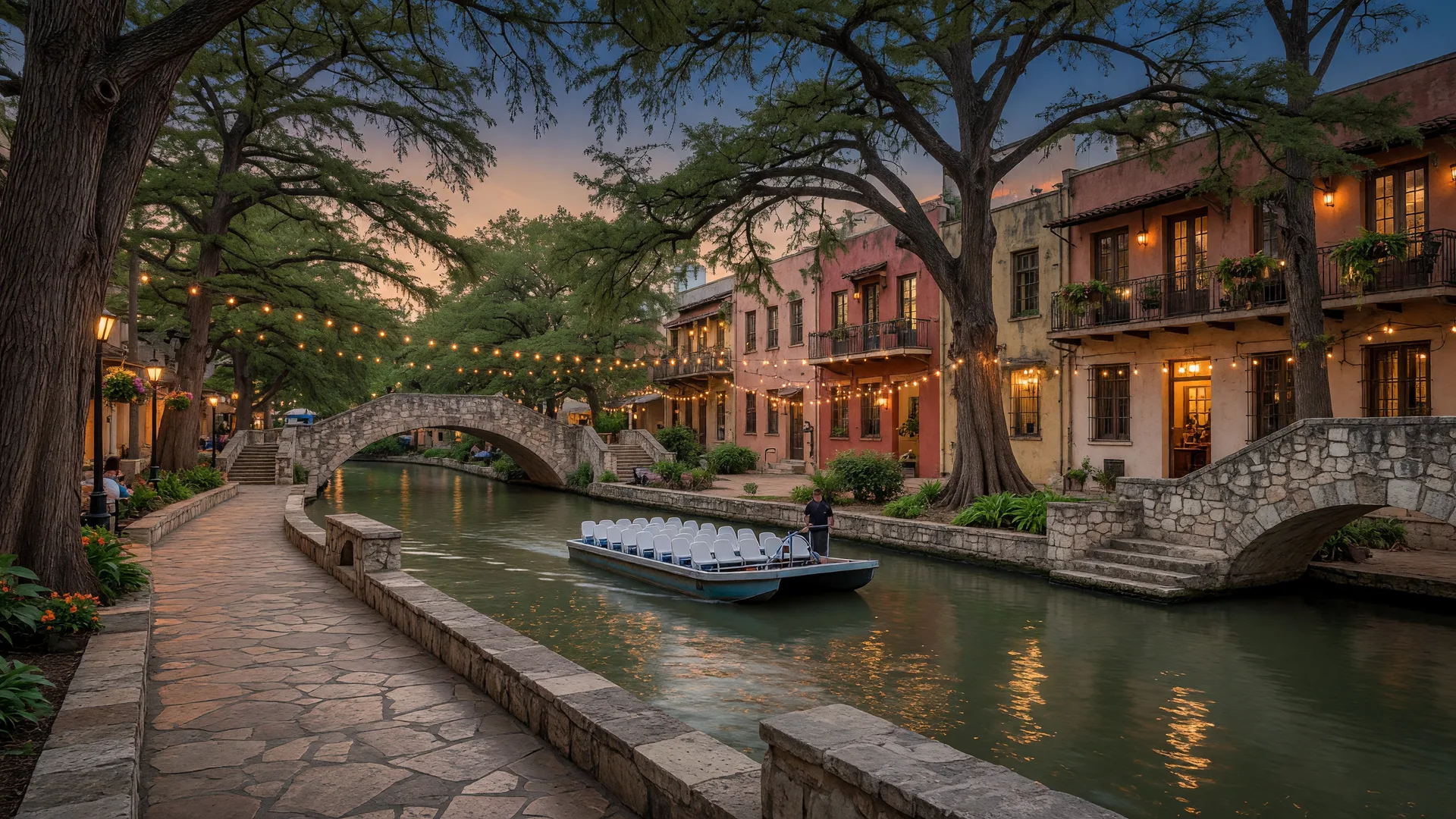
The San Antonio River Walk is a roughly 15-mile network of below-street-level pedestrian walkways built along the San Antonio River, and it is the closest thing the Texas Hill Country has to a waterfront downtown [1]. It is free to walk, open year-round, and it functions differently for residents than it does for tourists: the downtown loop is the restaurant and nightlife corridor, the Museum Reach connects north to the Pearl District, and the Mission Reach is an eight-mile restored river trail that runs to the UNESCO World Heritage missions [3][4].
This guide covers the numbers that matter to a California relocator: how long the system actually is, what each of the three sections is for, what the boat tour costs, which landmarks sit along the water, what the seasonal events involve, and how far it all sits from Boerne, Fair Oaks Ranch, and the rest of the Hill Country. Sources are listed at the end of the article and were checked October 15, 2026 [13][14].
The River Walk at a Glance
| Total system | Roughly 15 miles, from the river's source north of downtown to past Loop 410 |
| Downtown horseshoe loop | About 2.5 miles of walkway counting both banks; the waterway through downtown is about 1.5 miles |
| Museum Reach | 1.3 miles north from the Lexington Avenue Bridge to the Pearl; opened 2009; barges reach the Pearl via the Brooklyn Avenue lock and dam |
| Mission Reach | 8 miles of restored river corridor south of downtown with 16-plus miles of trail; opened in phases 2011-2013 |
| Narrated boat cruise | GO RIO, $16.78 per adult including tax, about 35 minutes, daily roughly 10 a.m. to 10 p.m. year-round |
| Drive from Boerne | About 30 miles and 35 to 45 minutes to downtown via I-10 on a normal day |
| Drive from Fair Oaks Ranch | Roughly 10 minutes less than Boerne |
| Walk from the Alamo | About a third of a mile, an 8 to 10 minute walk |
Figures as published by the San Antonio River Authority, the River Walk official site, and GO RIO Cruises. Confirm hours and prices before a visit.
How the River Walk Was Built: A History That Explains the City
The River Walk exists because of a flood. On September 9 and 10, 1921, remnants of a Gulf hurricane dropped up to 14 inches of rain on San Antonio in a 23-hour stretch, flooding roughly a thousand acres with water up to nine feet deep on Houston Street and killing at least 51 people [7][8]. The disaster forced a flood-control decision, and one proposal was to pave the river over as a concrete storm sewer. The San Antonio Conservation Society fought that plan, and by 1926 work began on the Olmos Dam and a bypass channel instead [8].
The second piece came from a local architect. In 1929, Robert H. H. Hugman proposed a below-street-level promenade of winding paths, bridges, shops, and greenery along the river, which he called the "Shops of Aragon and Romula" and later the Paseo del Rio [7]. His argument to city leaders was simple: the river was an asset, not a drain. The plan was formally adopted in 1938 once Works Progress Administration funding was available, and Hugman served as supervising architect during construction from 1939 to 1941, designing 31 staircases, bridges, water features, and an outdoor theater [7][9].
The River Walk opened in 1941 and remains a designated Historic Civil Engineering Landmark, because it solved two problems at once: flood control and urban recreation [9]. That dual origin is why it looks the way it does, one level below the street, shaded, and built around the river rather than against it. For a California relocator, the useful takeaway is that this is not a manufactured tourist district; it is an engineered piece of the city's infrastructure that San Antonians have used for more than eight decades.
The Three Sections: Downtown Loop, Museum Reach, and Mission Reach
Thinking of the River Walk as one continuous trail misses how it actually works. The system is three connected sections with three different jobs [1][3][4].
The downtown horseshoe loop is the famous part: the below-street-level channel through the heart of downtown, lined with restaurants, bars, hotels, and shops, crossed by dozens of low stone footbridges. This is where the tourist barges run and where the riverfront dining is concentrated. It is roughly 2.5 miles of walkway counting both banks, and it is the section a first-time visitor means when they say "the River Walk" [1].
The Museum Reach extends about 1.3 miles north from the Lexington Avenue Bridge to the Pearl District, opened in 2009 [3]. It is newer, wider, and more landscaped than the downtown loop, with native plantings, public art installations, kayak launches, and pedestrian connections into residential neighborhoods. The barges reach the Pearl through the Brooklyn Avenue lock and dam, which raises boats about nine feet [2][3]. For residents, the Museum Reach is the section that turns the River Walk from a tourist corridor into a daily walking and cycling route.
The Mission Reach runs 8 miles south of downtown to the historic missions, a restored river corridor opened in phases from 2011 to 2013, with 16-plus miles of trail [4]. It is a linear park, not a shopping street: native grasses, restored wetlands, limestone weirs, and a wide paved path for walking and cycling. It connects to the missions that give the section its name, which is why the San Antonio missions guide treats the Mission Reach as the trailhead for visiting them.
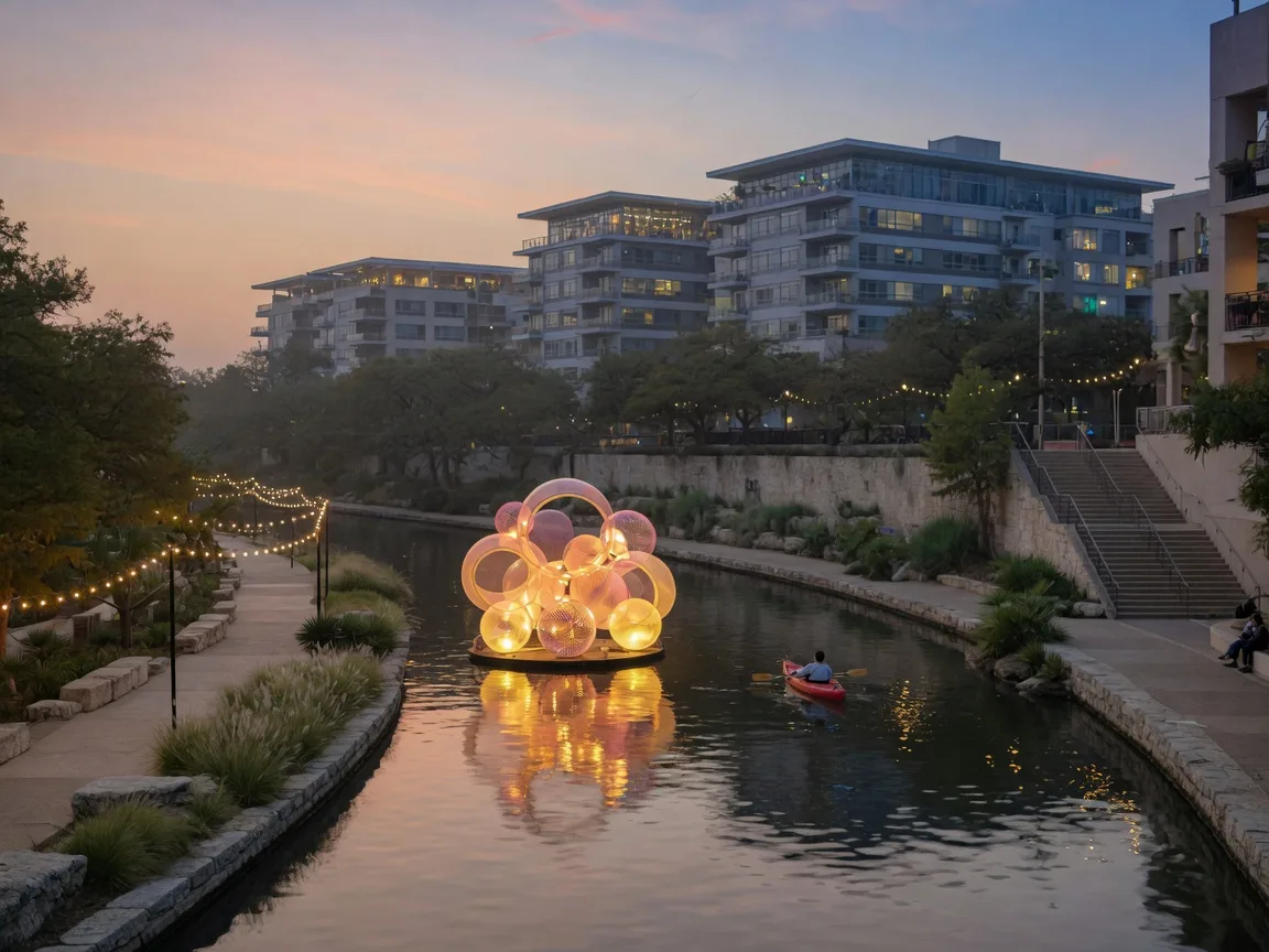
Together the three sections run the length of San Antonio's riverfront, from the Pearl at the north end to Mission Espada at the south, and a determined cyclist or runner can cover the whole corridor in a single outing [3][4].
The Boat Tour: The One Thing First-Time Visitors Do
The narrated boat tour is the standard introduction to the River Walk, and the price is low enough that it is the cheapest structured way to get oriented in downtown San Antonio. The GO RIO cruises run flat-bottomed barges along the downtown loop; an adult ticket is $16.78 including tax, the tour lasts about 35 minutes, and it covers roughly 1.5 miles of the river with a live narration of the landmarks and history [5][6]. Cruises operate daily from about 10 a.m. to 10 p.m. year-round [6].
For a family of four, the boat tour plus a riverfront meal is a realistic half-day in downtown that costs less than a single admission to a California theme park, and it is the one activity on the River Walk that is worth doing before you explore on foot, because the narration explains what you are looking at. On weekday mornings the boats are quiet; weekend evenings are the busiest window [5][6].
The same operator runs river taxis along parts of the system, which some residents use as a fun alternative to walking between restaurants, though the River Walk is compact enough that walking is usually faster [5]. The San Antonio attractions guide places the boat tour in the full picture of what the city offers a new resident.
Landmarks Along the Water
The River Walk connects several of San Antonio's defining places, and most of them are free to visit.
The Arneson River Theatre is a WPA-built outdoor amphitheater from 1939 to 1941, with roughly 800 limestone seats facing a stage across the river, so the audience watches performers on the far bank [10]. It is named for Edwin P. Arneson, the engineer who secured the funding for the Paseo del Rio, and its entrances are inside La Villita. It hosts free public programming through the year, including Fiesta events [10].
La Villita, on the south bank of the downtown loop, is one of San Antonio's first neighborhoods, with roots back to an 18th-century settlement. It was restored as an arts village in 1939 and is now a National Register Historic District of 27 nineteenth-century buildings filled with artisan shops and galleries [11].
The Tobin Center for the Performing Arts sits on the river at 100 Auditorium Circle, preserving the facade of the historic Municipal Auditorium behind a modern performance hall of roughly 1,750 seats [12]. Its outdoor Will Naylor Smith River Walk Plaza has a 32-foot video wall and a water-taxi portal, so you can arrive at a concert by boat [12].
The Pearl, at 303 Pearl Parkway, is the northern terminus and turning basin of the Museum Reach, where the barges swing around at the end of the line [3]. The Pearl is the city's food and brewery district, with its own farmers market, and it is where the River Walk's north end meets San Antonio's modern culinary scene.
The Alamo is about a third of a mile from the river, an 8 to 10 minute walk, and stairs next to the San Antonio Visitor Center, across from the Alamo, descend directly to the River Walk level. For planning purposes, the Alamo and the River Walk are one visit [1].
Seasonal Events on the River
The River Walk is at its most useful to a new resident during the two big annual events that take over the water.
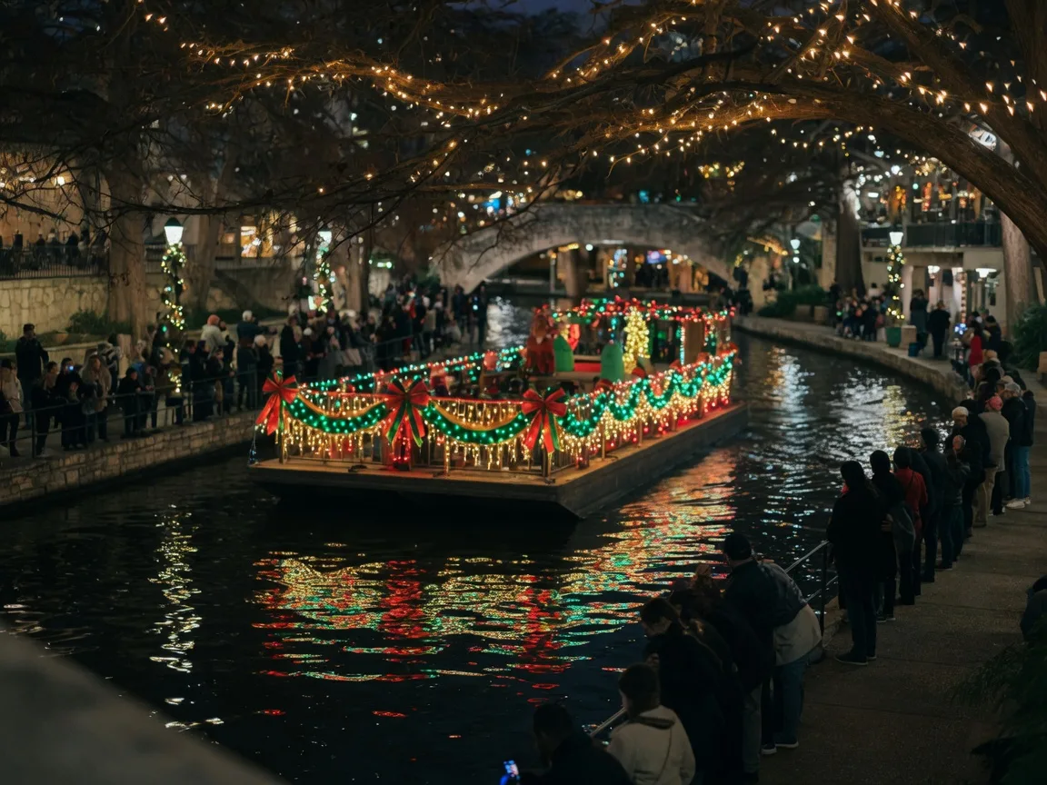
The Ford Holiday River Parade runs the day after Thanksgiving every year, and in 2026 that is Friday, November 27, the 45th annual parade [13]. Decorated, illuminated barges float the downtown loop starting at the Tobin Center, with the first float departing at 6 p.m. and the live broadcast beginning at 7:05 p.m. from the Arneson River Theatre [13]. It is the largest holiday event on the River Walk, and the evening lighting along the cypress trees from late November through New Year's is free to walk [13].
Fiesta, the city's April civic festival, brings the Texas Cavaliers River Parade of decorated boats to the River Walk, the tradition that has run since 1941. The Fiesta guide covers the 2027 dates and logistics, and it is the one week of the year when the River Walk is genuinely crowded.
Between those two anchors, the River Walk hosts smaller programming through the year, and the month-by-month social calendar places the river events in the context of the full Hill Country year. For a relocator deciding when to visit, the holiday season and the two parade nights are the calendar's peak.
What the River Walk Means for a Relocator
For a California transplant, the River Walk changes the character of a Hill Country commute. Living in Boerne or Fair Oaks Ranch means a 35 to 45 minute drive to downtown San Antonio, and the River Walk is the reason that drive leads somewhere a city dweller actually wants to be: a free, shaded, walkable waterfront with restaurants, concerts, a food district at the Pearl, and an 8-mile trail down to the missions [14]. That combination is the core of what the San Antonio lifestyle guide calls the city's best asset for new residents.
Residents use it differently than visitors. Locals walk or cycle the Mission Reach on weekends, run the Museum Reach on weekday mornings, take out-of-town guests on the boat tour once, and use the downtown loop as the default spot for a celebratory dinner [3][4]. The daily rhythm is cheap: walking the River Walk costs nothing, the Pearl's public spaces are free, and even the touristy parts carry no admission [1].
The honest tradeoff is distance. The River Walk is not in your backyard the way a California coastal promenade might be if you live in a beach city. It is a 30-mile drive from Boerne, which makes it a destination for most residents rather than a daily amenity [14]. The Boerne to San Antonio commute guide lays out the real drive-time picture, because that distance is the single most important factor in how often you will actually use the River Walk.
How the River Walk Compares to California Waterfronts
California transplants usually need a frame of reference, and the honest answer is that the River Walk has no exact California counterpart. The closest structural comparisons, the Los Angeles River greenway and the San Francisco Embarcadero, are different in kind: the River Walk is a single connected, below-street-level promenade with boats, restaurants, and free public programming, running continuously from the Pearl to the missions [1][3][4].
What it most resembles is a hybrid of things Californians know separately. The Museum Reach and Mission Reach read like a landscaped urban river trail, the kind of thing the LA River system is working toward. The downtown loop reads like a compact, walkable waterfront entertainment district, but without the admission gate or parking fee that California's equivalents often carry. And the whole thing is free, which is the part that surprises most visitors from the coast.
The practical point for a relocator is location: in California, a genuine urban waterway is usually a 30-minute drive from a suburban home, and the River Walk is exactly that from Boerne and Fair Oaks Ranch. It is an urban amenity with a rural-adjacent address, which is a fair summary of the Hill Country value proposition in general.
Practical Logistics for First Visits
Parking. There is no parking on the River Walk itself. The practical play is a downtown garage, several of which sit within a block or two of the loop, or a rideshare that drops you at street level above a set of stairs. On parade nights and Fiesta evenings, garages fill by mid-afternoon, so plan the walk from wherever you park.
When to go. The mild months, October through April, are the comfortable window, with daytime highs mostly in the 60s to 80s and cool evenings. Summer evenings work because the cypress canopy keeps the river level several degrees cooler than the street above, which is the River Walk's best climate feature. Midday summer is the least comfortable option.
Cost of a family day. Walking the River Walk is free. A realistic family visit, including the boat tour, parking, and a meal, lands in the $100 to $150 range, and a minimal visit, just the walk and the missions trail, can cost nothing but fuel.
Combining with the missions. The Mission Reach is the efficient way to see the river and the missions in one outing. Start at the Pearl or downtown, ride or walk the corridor south, and return the same way. The missions guide has the route and access details.
The Bottom Line for Relocators
The San Antonio River Walk is a 15-mile free public amenity that a Hill Country resident can reach in 35 to 45 minutes, and it is one of the strongest quality-of-life arguments for the San Antonio side of the relocation decision [1][14]. The downtown loop is the restaurant and nightlife corridor, the Museum Reach connects to the Pearl, and the Mission Reach is an 8-mile trail to the missions. The boat tour costs $16.78, the walkways cost nothing, and the two big annual events, the Ford Holiday River Parade on the day after Thanksgiving and the Fiesta river parade in April, are worth planning around [5][6][13].
If you are evaluating a move to Boerne, Fair Oaks Ranch, or San Antonio, the attractions guide, the lifestyle guide, and the missions guide cover the rest of the city, and the commute guide has the honest drive-time math. When you are ready to talk neighborhoods, schools, and the actual house hunt, reach out for a no-pressure conversation about your specific situation.

Written by
Bill Ross
Hill Country Homesteads Group, brokered by KW Boerne
Bill Ross is a Texas real estate agent (TX license 778434) serving Boerne, Fair Oaks Ranch, San Antonio, and the surrounding Hill Country, with a direct network of 1,100+ California real estate agents for coordinated cross-state relocations. He has been recognized in USA Today and The Washington Post for his relocation expertise, and his own family made the Silicon Valley to the Hill Country transition.
Related Guides
San Antonio Attractions Guide
The Alamo, River Walk, theme parks, and museums with distances, prices, and tips from Boerne.
San Antonio Lifestyle Guide
What daily life in the Alamo City looks like for California transplants, from dining to healthcare.
The San Antonio Missions
The UNESCO World Heritage missions and the Mission Reach trail, with distances from Boerne.
The Boerne to San Antonio Commute
Real drive times, the I-10 and Loop 1604 rebuild, and the airport run for Hill Country residents.
Fiesta San Antonio 2027
The April festival's parades, ticket math, and logistics, including the River Walk river parade.
The Month-by-Month Social Calendar
The Hill Country's annual rhythm of events, from spring festivals to the December holidays.
Frequently Asked Questions
The questions California relocators actually ask about the River Walk, with answers traced to the sources below.
Is the San Antonio River Walk free?
Yes. The walkway itself is a free public space open year-round, day and night. You pay only for the narrated boat tours, dining, and ticketed events such as the Ford Holiday River Parade grandstand seats. The Mission Reach trail and most public programming are free.
How long is the San Antonio River Walk?
The full system is roughly 15 miles, from the river's source north of downtown to past Loop 410. The downtown horseshoe loop is about 2.5 miles of walkway counting both banks, the Museum Reach adds 1.3 miles north to the Pearl, and the Mission Reach is 8 miles of restored river corridor south of downtown.
How much does the river boat tour cost?
The GO RIO narrated cruise is $16.78 per adult including tax (a $15.50 ticket plus $1.28 tax). The tour runs about 35 minutes and covers roughly 1.5 miles of the downtown loop. Cruises operate daily from about 10 a.m. to 10 p.m. year-round.
How far is the River Walk from Boerne and Fair Oaks Ranch?
Downtown San Antonio, where the River Walk loop sits, is about 30 miles from Boerne and a 35 to 45 minute drive via I-10 on a normal day. Fair Oaks Ranch is roughly 10 minutes closer. The commute guide covers the corridor in detail.
Can you walk from the Alamo to the River Walk?
Yes. The Alamo is about a third of a mile from the river, an 8 to 10 minute walk. Stairs next to the San Antonio Visitor Center, across from the Alamo, descend directly to the River Walk level, so the two sights are effectively one visit.
When is the Ford Holiday River Parade?
The Ford Holiday River Parade runs the day after Thanksgiving every year. In 2026 that is Friday, November 27, the 45th annual parade. The first float departs the Tobin Center at 6 p.m., and the live broadcast starts at 7:05 p.m. from the Arneson River Theatre.
Sources
- River Walk system length, sections, and visitor FAQs - The San Antonio River Walk (official site). www.sanantonioriverwalk.com/questions-about-the-riverwalk/
- Museum Reach history and design - The Cultural Landscape Foundation. www.tclf.org/museum-reach
- Museum Reach: 1.3 miles, Lexington Avenue to the Pearl, opened 2009 - San Antonio River Authority. www.sariverauthority.org/parks-trails/san-antonio-river-walk-museum-reach/
- Mission Reach: 8 miles of restored river corridor, 16-plus miles of trail, opened in phases 2011-2013 - San Antonio River Authority. www.sariverauthority.org/parks-trails/san-antonio-river-walk-mission-reach/
- GO RIO narrated cruise: $16.78 adult total, 35 minutes - GO RIO Cruises / River Walk official site. www.goriocruises.com/overview/
- GO RIO cruise price and hours - Go Rio Cruises, Riverwalk Boat Cruises. www.sanantonioriverwalk.com/riverwalk-boat-cruises/
- Robert H. H. Hugman and the 1929 plan for the Paseo del Rio - Texas State Historical Association, Handbook of Texas. www.tshaonline.org/handbook/entries/hugman-robert-harvey-harold
- 1921 flood and WPA construction history - Wikipedia, San Antonio River Walk. en.wikipedia.org/wiki/San_Antonio_River_Walk
- River Walk and flood control system as an ASCE Historic Civil Engineering Landmark - American Society of Civil Engineers. www.asce.org/about-civil-engineering/history-and-heritage/historic-landmarks/san-antonio-river-walk-and-flood-control-system
- Arneson River Theatre: WPA-built outdoor theater, entrances inside La Villita - San Antonio River Walk official listing. www.thesanantonioriverwalk.com/listing/arneson-river-theatre-at-la-villita/4672/
- La Villita history and National Register Historic District - La Villita. www.lavillitasanantonio.com/History
- Tobin Center: location, performance hall, river walk plaza - San Antonio River Walk official listing. www.thesanantonioriverwalk.com/listing/tobin-center-for-the-performing-arts/2927/
- Ford Holiday River Parade: day after Thanksgiving, 45th annual in 2026, 6 p.m. first float, 7:05 p.m. broadcast - Visit San Antonio. www.visitsanantonio.com/blog/post/what-to-expect-at-the-ford-holiday-river-parade/
- Drive times from Boerne and Fair Oaks Ranch to downtown San Antonio - California to Texas Relocation Guide, commute guide. movetotexas.net/blog/boerne-fair-oaks-ranch-san-antonio-commute-guide/
Last reviewed: October 15, 2026. Sources verified for accuracy.